Hannah Clark Data Design
Data visualisations
With over 15 years experience in creating designs for a variety of clients, my work has expanded to taking data concepts and making them easier to understand.
01.

Global emissions
Pie chart of emissions, by continent
and searchable by type of industry. Data from the IEA.

03.
Problem establishing
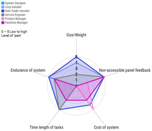
Radar map visualisations to showcase my ideations and problem-structuring relating to known users.
04.
Waterbirds
The what.
Waterbirds in the UK 2021/22: The Wetland Bird Survey and Goose & Swan Monitoring Programme.


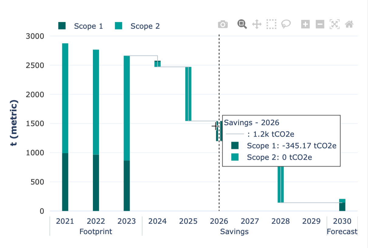
05.
Carbon footprint
The what.
Aggregation of the Scope 1 & 2 carbon emissions glidepath for the SaaS platform M2030. On hover, it states the emissions savings made in tCO2e. The graph is designed with brand colours in mind, using Plotly as the FE.
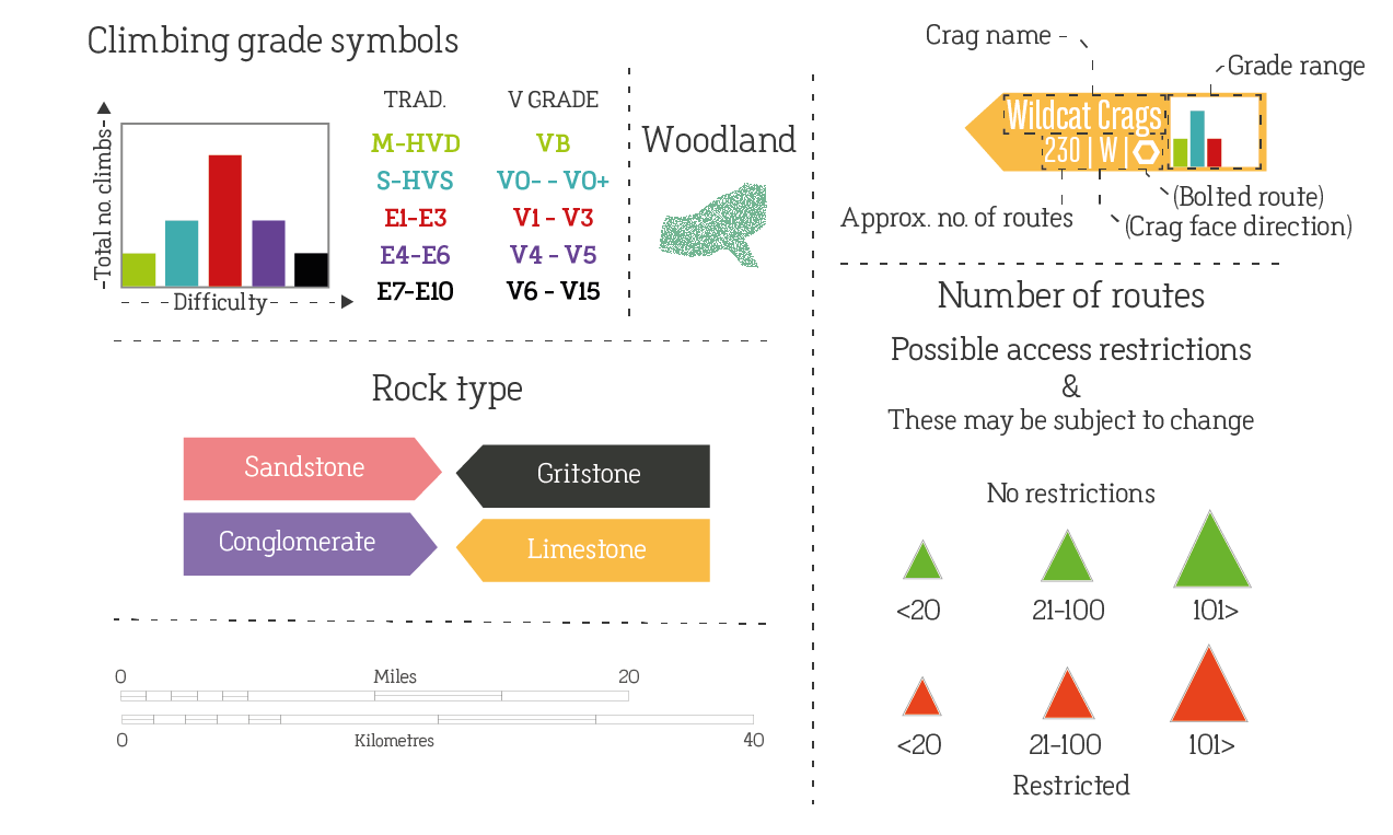
06.
Climbing map legend
The what.
Climbs within the Peak District were plotted onto a map, alongside key stats to guide climbers. On the map, I designed the legend to guide users.
© Hannah Clark 2024. All rights reserved.